Skip to content
 Hiking Kings Peak: The #1 Highest Peak in Utah
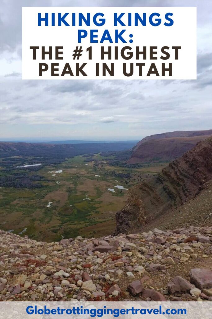
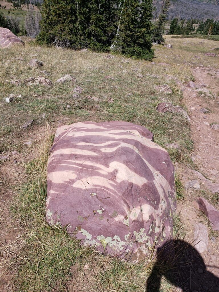
This last September I finally got around to hiking Kings Peak in Utah! It is the highest peak in the state and is a part of the Uinta Mountains Range. It has amazing views and beautiful…rocks. No seriously, I kept thinking to myself that there was no way some of the rocks up there were natural.
While many before me have conquered this beast, not as many complete the hike in a single day. For good reason too, if you are not in prime shape (which I wasn’t sadly) this strenuous mountain climb can and will kick your butte! We completed the hike in a day and a half, but I do recommend for most people to give yourself two to even three days, if you have the time.
Kings Peak is about 26 miles total trip, out and back and about half way I was feeling the burn. I wished I hadn’t eaten that egg, sausage and cheese breakfast burrito from Maverik that my friends talked me into a few hours before. Enough about me though let’s get to the hiking of Utah’s highest peak!
Quick Information
Length: 26 miles Out and Back
Difficulty: Hard, strenuous
Elevation Gain: 4,202 ft
Elevation: 13,528 ft above sea level
Trailhead: Henry’s Fork Trailhead, 40.909113, -110.331268
Map of the area and way points down at the bottom of post.
Directions: Henry’s Fork Trailhead (King’s Peak)
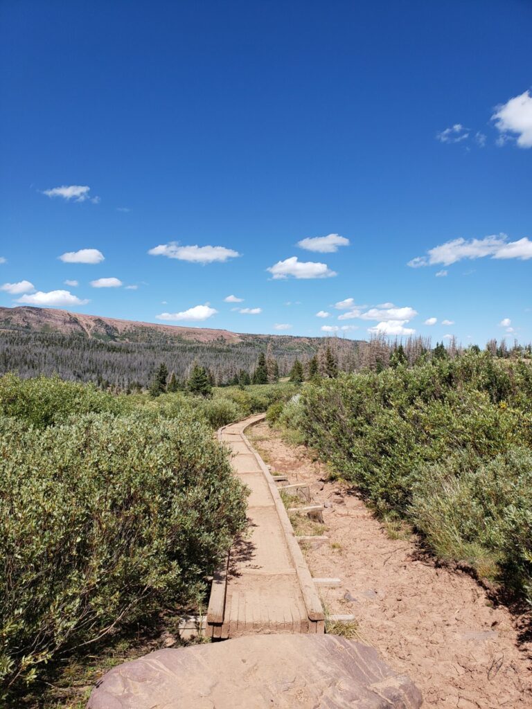
So where most people start the hike including myself is at Henry’s fork trailhead. If you are coming from Salt Lake City, Utah like we were, it was about a 3 hour drive. There are no fees or permits required to park and there is a fair amount of parking available. You should be aware however that this is a very popular trail and can get very busy at times.
I’d recommend getting there really early in the morning or camping the night if you can. We got to the parking lot at 05:30 on a Saturday and still had to park a ways from the actual trailhead and all the camping sites were full. When we came back the next day in the afternoon there were like 5 cars in the parking lot compared to the 50 the day before, so it all just depends.
Directions: From Mountain View, take Highway 410 south about 6 miles to a junction. then take Road 017, a gravel road, south about 12 miles to a fork, The east road, road 077 heads south about 5 miles to Henrys Fork.
How difficult is Hiking Utah’s Kings Peak?
Difficulty: Strenuous 25-30 mile, out and back
The first half of the hike (10ish miles) is not bad at all. It is a mostly dirt trail with some rocky parts thrown in. There are a couple steeper inclines, but for the most part you’re dealing with just a slight incline.
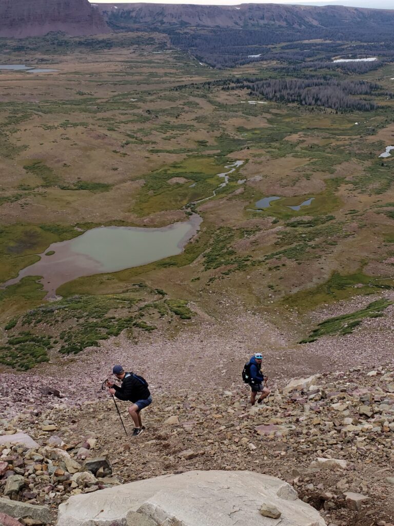
The second half you will be facing very steep inclines and even doing a lot of boulder hopping/rock walking. Watch them ankles!
We did have packs on and I’ll preface this by saying while I am fairly active, I was in no way backpacking the highest point in Utah active/ready. It was kind of a last minute thing because my friend was moving out of the state and we had always wanted to hike Kings Peak together. With that in mind the hike wasn’t terrible, but also I was sore for a week after haha.
Hiking to Dollar Lake
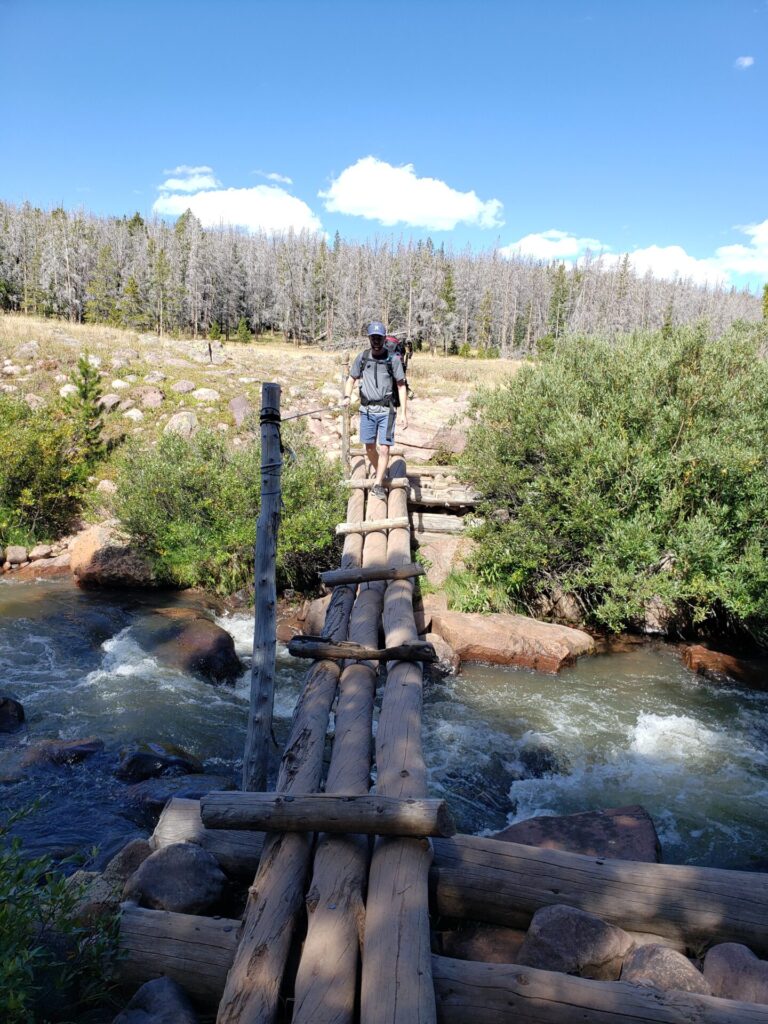
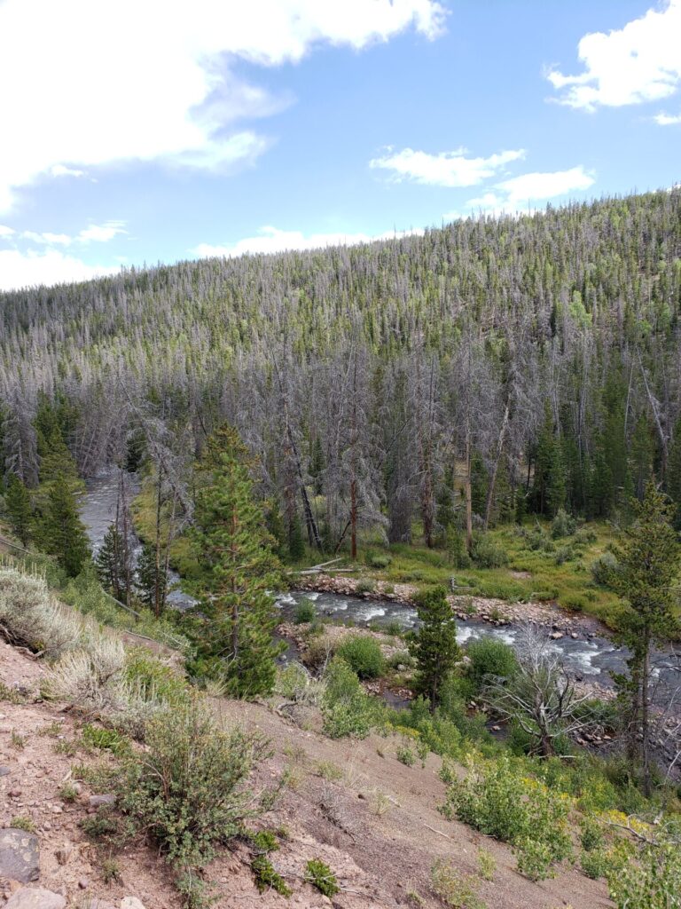
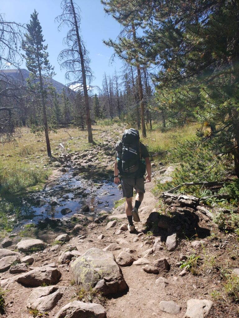
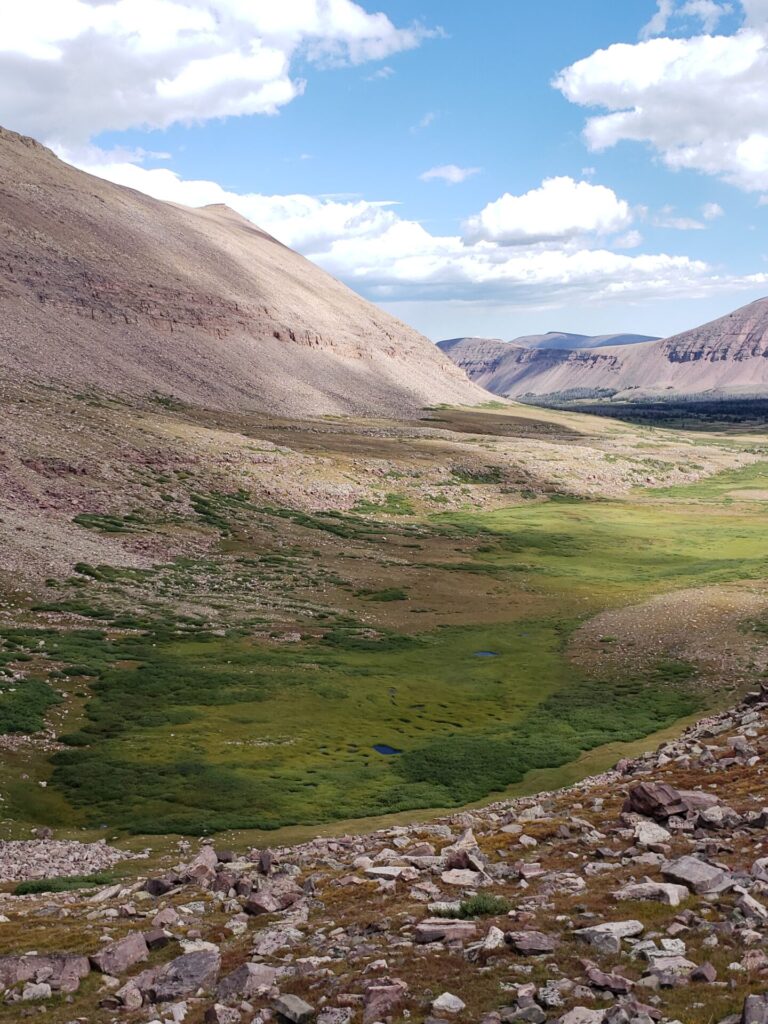
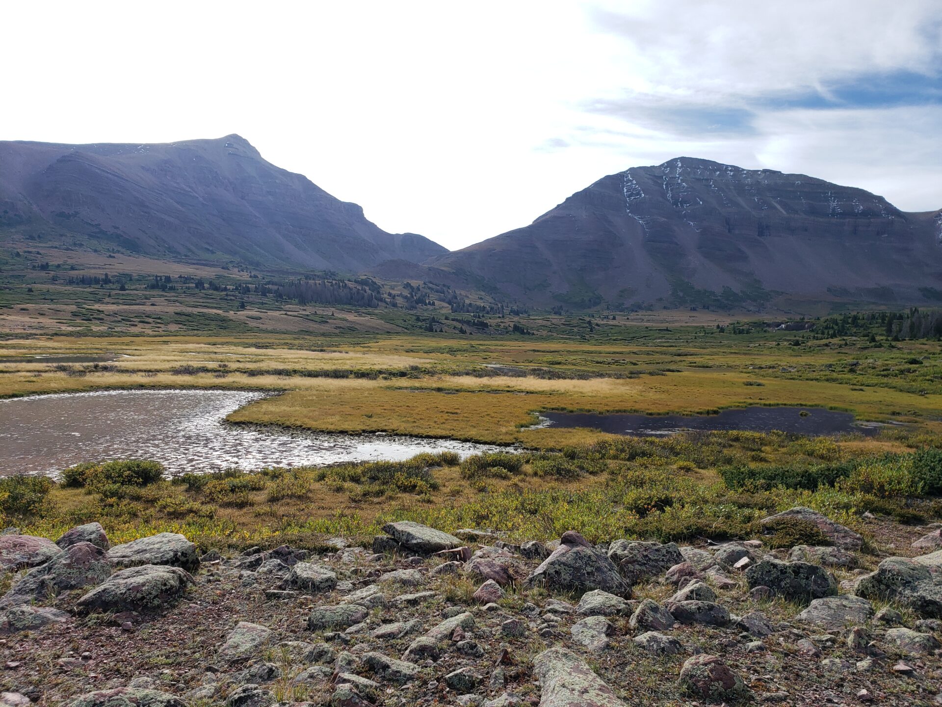
There are a number of lakes and ponds along this hike with the main ones being Dollar Lake, Alligator Lake and Henry’s fork Lake. Most people hike to one of these and make camp before taking on Kings Peak. You will, for a good amount of time be walking alongside a river and eventually cross over on a semi-sketchy bridge known as Elk horn bridge.
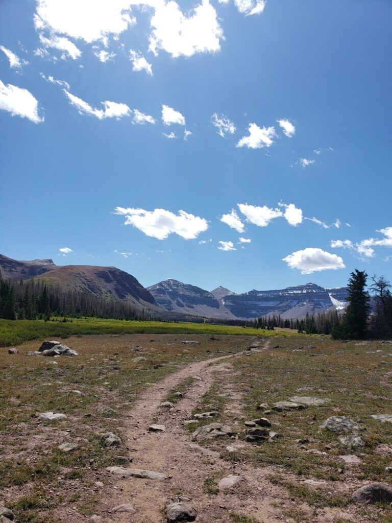
Up until this point you have mostly been surrounded by forest, but once you cross the river you’ll hit a few more pockets of trees before coming into a wide open valley. This valley had a ton of snow melt while we were there and a lot of the trail was completely flooded/muddy.
We had planned to hike to Dollar Lake, drop the packs and set up camp for the day. Then just mess around, maybe do some fishing and summit Kings Peak in the morning. That was the plan alright, but when we hiked the 7.3 miles to Dollar Lake we looked up the weather and saw that there was supposed to be a storm coming early in the morning. This was unexpected because the night before the weatherman said clear skies until the evening, but oh well.
Hiking to Gunsight Pass
We made the call that my body didn’t want to hear. We setup the tents and dropped our main packs. Grabbed some day bags and started our journey to the peak.
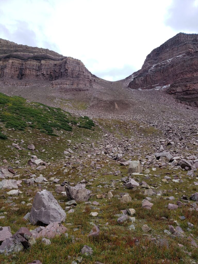
Once you’ve made it to Dollar Lake the next 3ish miles will have you climb about 1,000ft to Gunsight Pass. There are some switchbacks just below the pass. When we were there they had some ice and a lot of running water/mud.
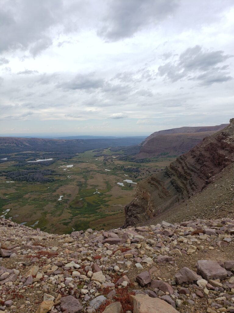
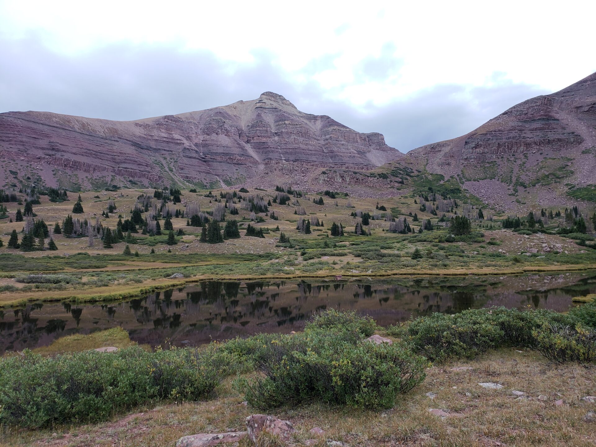
Gunsight Pass has a beautiful view of the valley behind you that you just hiked from, but also an awesome view of a valley in front of you known as Painter Basin. Here is where we took a little break to take in the views and eat a snack.
From Gunsight Pass you can continue down the trail that drops you into Painter Basin for about 1.5 miles before you climb back up towards Kings Peak.
There is also a shortcut that will shave off quite a bit of time. Instead of heading down into Painter Basin at the top of Gunsight, you will head west and follow the ridge a little ways and go up and over. We saw people doing this, but we had a dog with us and I didn’t feel like carrying her up all the rocks.
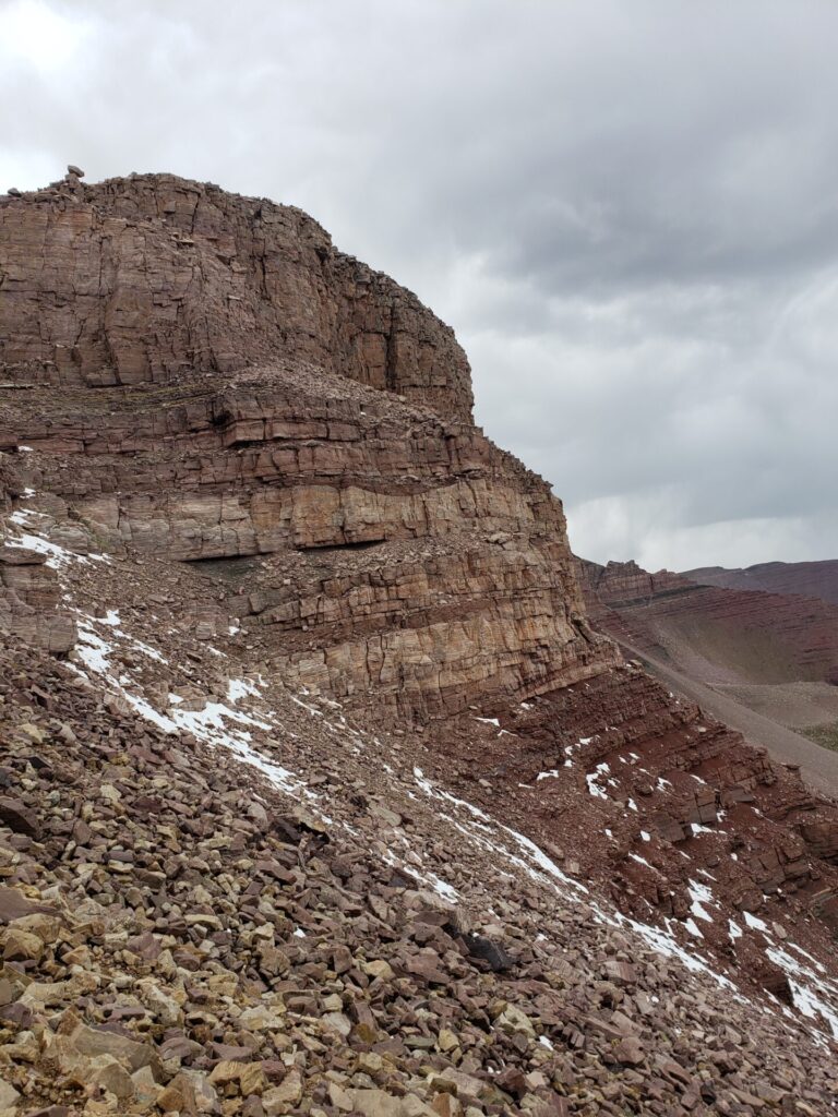
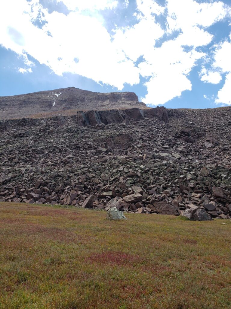
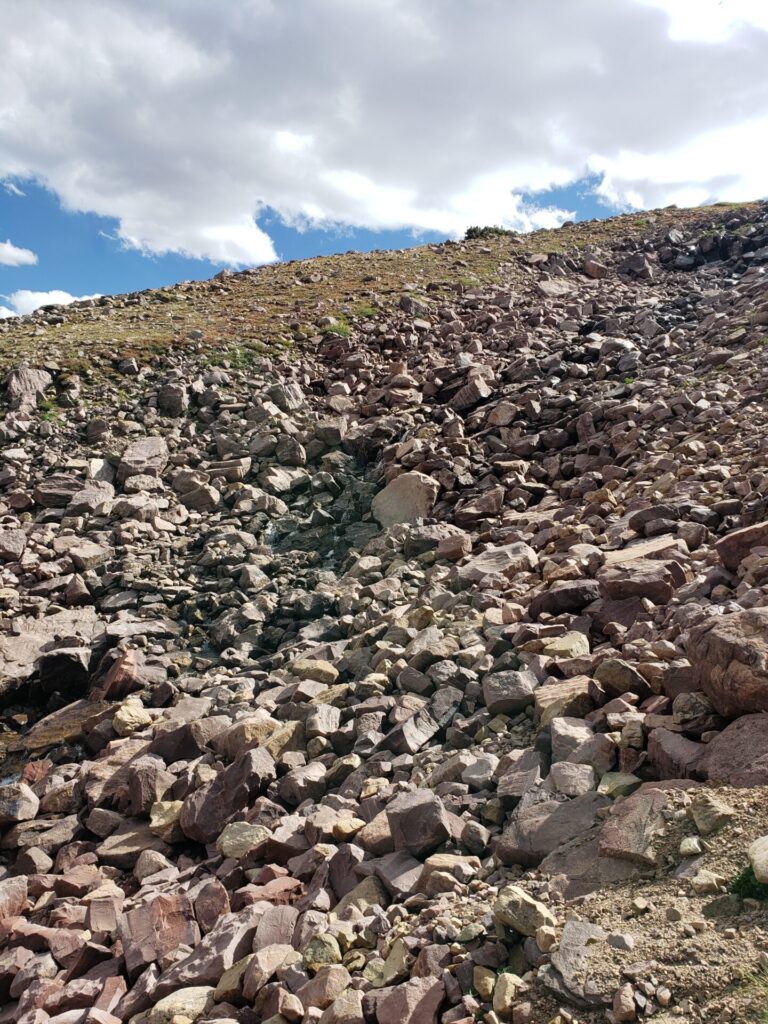
The shortcut involves quite a bit of rock scrambling and a little climbing. Once you get up and over the ridge depending on if there’s snow or not there may not be a clear path to Anderson Pass. Even on the main trail it’s just a sea of rocks and boulders until you start the final ascent to kings peak.
Anderson Pass
From Gunsight you’ve now made it another 3ish miles depending on whether or not you took the main trail or shortcut. This is another view area with gorgeous views and the final stop before the push to the top of Kings Peak! It was about here when the clouds above us started to darken and the wind was picking up. We had made it this far though and had to push on!
Hiking to the Top of Utah’s Kings Peak
From Anderson Pass upwards there were a ton of loose rocks and snow covered ground. The wind was picking up and the temperature was dropping, but manageable. You will want to be extra cautious because you might be sore, tired and so close to the top, but hold in your excitement and take it easy and get ready to scramble. From Anderson Pass to the top is a little more than half a mile, but you will be working for it.
Note: With Kings Peak being the highest point in Utah, you will want to watch the weather very closely as there are frequent thunderstorms in the area. Being the tallest thing around when lighting comes barreling from the heavens is not advisable!
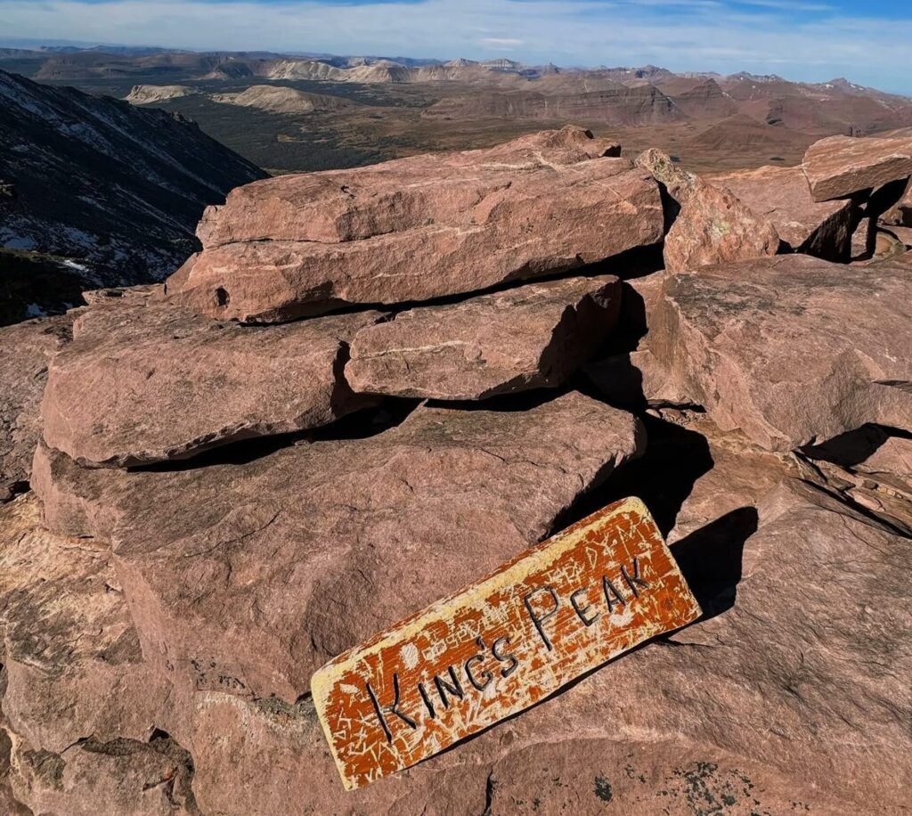
The Highest Point in Utah
Congrats you made it! At the top there is a little wooden sign that will greet you. You now have made it to the highest point in the state, 13,528′. Woohoo. Take in the wonderful sights and be grateful for the Uintah Mountains and their never ending beauty.
For us it was short lived because the clouds were really starting to darken and freak us out. So we looked around grabbed some pictures and went right back down.
Climbing Back Down Kings Peak
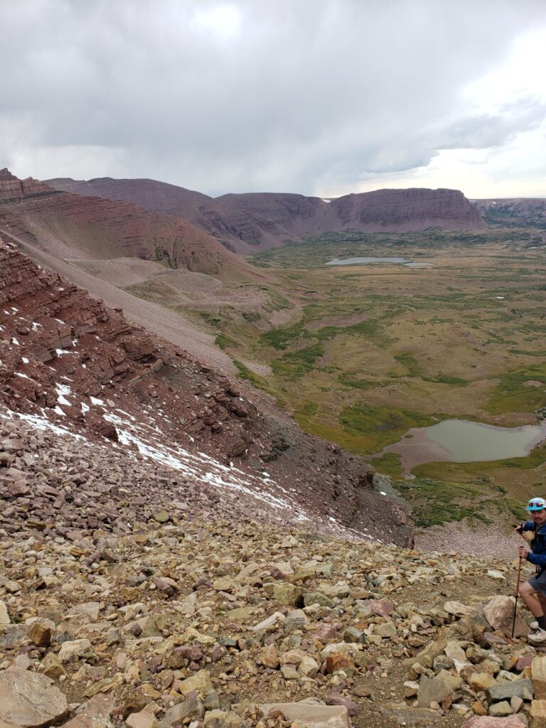
Once you make it back to Anderson Pass you now have 3 options for the journey back. You can either take the shortcut back down to gunsight pass, take the main trail back in to Painter Basin or what us and a couple other groups did, the shorter, shortcut. The main trail back is the easiest of the three, take this if you don’t want to worry about loose rocks and sliding down the side of a mountain.
The path we went down was north east of Anderson Pass, just follow the ridge until you are looking over the valley you initially came from. From the top you will be able to see all the lakes you passed hours before.
I believe most call this the chute. It has a lot of loose rocks and can be very challenging if you aren’t used to this sort of thing. If you are with others make sure you try and stay in line with each other or not directly below someone. There are many times that you will be sliding down rocks until they catch into some more rocks and occasionally a stray rock may barrel down the side of the mountain.
Getting down this way was fun, but scary at times and my shins hated me after. Once you get to the bottom you can just head back to the main trail to the east.
Note: Going down the chute is definitely not for the faint hearted or those that aren’t confident in their hiking abilities. There was a group that talked their friend into it and she seemed very hesitant and scared. Due to this, they were slow moving and still only half way down by the time we made it to the bottom and back to the main trail. So it could turn into a non-shortcut if you aren’t comfortable with it.
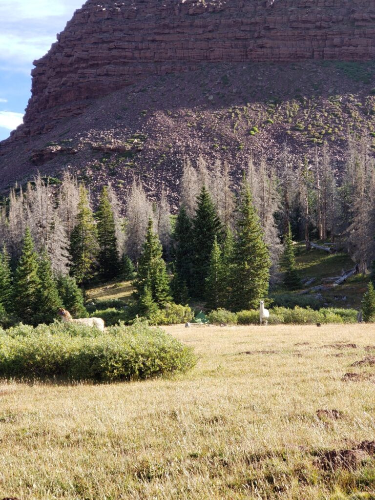
Camp at Dollar Lake
We had our tents setup near Dollar Lake. We ended up staying the night, it did get pretty chilly so make sure you bring layers. We all woke up with some sore muscles and hungry bellies, but ready to hit the trail back to the car.
Around this area you can walk around and explore or try your luck at some fishing in one of the nearby lakes. There were a few fisherman at Henry’s fork lake when we walked over there. One was reeling in a rainbow trout as we were passing by.
Journey Home
The hike back to the car was nice as the majority of it is flat. This being the first backpacking trip I’ve done in years, I can tell you my poor little legs were done by the time I got back to the car and the next couple days after. This is not your typical hike and it definitely beat me and my buddy up in the end. The journey to Kings Peak was worth it though and now I can go brag to friends and family that I have stood higher than them. That will win any argument, guaranteed!
Tips for Hiking Kings Peak
- Bring a water filter if you have one. There are a lot of places up until Gunsight Pass to fill up your water.
- Check the weather and recent reviews to find out how the trail looks. There are spots where ice and snow would be very dangerous if you are not prepared. Same with Lightning!
- If you aren’t in that great of shape, don’t try this in one day! Trust me, if you don’t have the time come back another time. For the majority of people 2-3 days.
- Bring a good rain jacket and water proof shoes/boots. The weather can be unpredictable and we ran into a lot of flooded trails, snow and rain. (September)
- Dollar Lake is a very popular camping stop and was filled with people when we went. We actually went a bit passed it and found a really good spot in the trees to setup camp.
- Mosquitoes can be ravenous in these parts so make sure if you get eaten alive like I do, that you pack some counter measures.
- There is a lot of time in the sun and it is very easy to get burnt because of the cooler weather. Bring sunscreen and a hat.
- Dogs are allowed and can be off-leash in some areas. Every dog we saw was off-leash.
- Get ready to see lots of people, this is a very popular hike and well traveled.
Wildlife
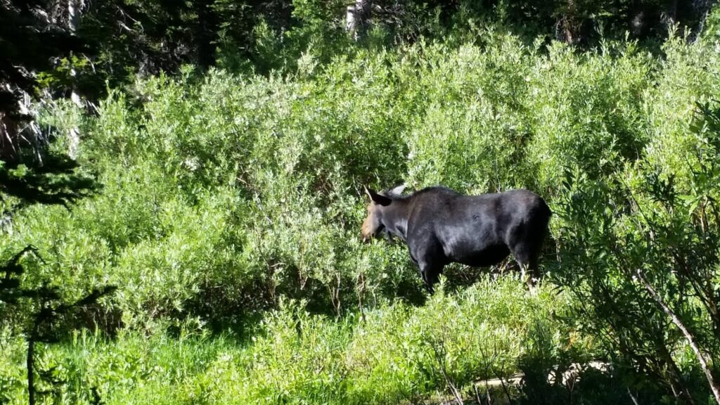
While on the hike we saw a couple moose, a mountain goat and a pair of llamas. Beware of mountain lions and rattle-snakes in the area! There were quite a few hunters looking for ptarmigan and having success.
Interactive Map For Hiking Kings Peak in Utah
Few More Pictures
There you have it! My adventure Hiking Kings Peak, the highest peak in Utah!
Do you plan on hiking Kings Peak? Already did? What other hikes in the Uinta Mountains do you love? Let me know in the comments!
Read Next: